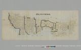
地図
ImageImageImage

天保時代水戸地図

Icons representing 地図
The cover of this title could differ from library to library. Link to Help Page

天保時代水戸地図

Material type
地図
Author
-
Publisher
-
Publication date
-
Material Format
Digital
Capacity, size, etc.
43.0cm、111.5cm
Scale
-
View All

Notes on use

Note (General):

写年代不詳カテゴリ名:地図公開範囲:ウェブ公開

Search by Bookstore

Holdings of Libraries in Japan

This page shows libraries in Japan other than the National Diet Library that hold the material.

Please contact your local library for information on how to use materials or whether it is possible to request materials from the holding libraries.

other

  • デジタルアーカイブ

    Digital
    You can check the holdings of institutions and databases with which デジタルアーカイブシステムADEAC is linked at the site of デジタルアーカイブシステムADEAC.

Bibliographic Record

You can check the details of this material, its authority (keywords that refer to materials on the same subject, author's name, etc.), etc.

Digital

Material Type
地図
Title Transcription
テンポウジダイミトチズ
Extent
43.0cm、111.5cm
Text Language Code
jpn
Target Audience
一般
Note (General)
写年代不詳
カテゴリ名 : 地図
公開範囲 : ウェブ公開
Collection (particular)
水戸城下絵図
Access Restrictions
インターネット公開
Rights (production)
該当なし