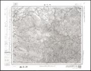
御代田(昭和37年)
Digital data available(軽井沢町立図書館デジタルアーカイブ)
Begin reading now
デジタルアーカイブシステムADEAC
Search by Bookstore
Holdings of Libraries in Japan
This page shows libraries in Japan other than the National Diet Library that hold the material.
Please contact your local library for information on how to use materials or whether it is possible to request materials from the holding libraries.
Search by Bookstore
Bibliographic Record
You can check the details of this material, its authority (keywords that refer to materials on the same subject, author's name, etc.), etc.
- Material Type
- 地図
- Title
- Title Transcription
- みよた(しょうわ37ねん)
- Publication, Distribution, etc.
- Publication Date
- 1962/8/30
- Publication Date (W3CDTF)
- 1962
- Extent
- 1P
- Text Language Code
- jpn
- Area Coverage
- その他のエリア
- Subject Heading